
Walk Farmington Streets by Address
A Farmington street directory works best as a chain of address-keyed records. Begin with the number and street already in hand, then use the Assessor to identify the parcel and the Town Clerk to test the legal trail. GIS can show the lots beside it. Voter information may add a lawful registration signal. The Farmington Room can place earlier occupants at the same address. These sources overlap, but they do not describe the same people or time period.
Keep a research note for each result. Record the source, search date, exact spelling, parcel ID or MBL, and whether an address is a physical situs or a tax mailing line. That small habit prevents a property owner, a business, and a past occupant from becoming one unsupported identity.
- Run the number and street through the Farmington Property Record Cards search. Save owner, unit, unique ID, MBL, use, and mailing distinction.
- Open the same parcel in Farmington GIS. Confirm the street label, adjacent lots, parcel shape, and any subdivision or condominium context.
- Use the official Connecticut voter route only for a lawful, permitted purpose, and treat a registration record as a limited signal.
- Search the Town Clerk’s RecordHub index for the latest deed, then follow the prior grantor and referenced volume or page.
- For past households, turn to reverse or criss-cross directories, newspapers, historic-home files, and a matching census or obituary.
Farmington Assessor Property Records
The Farmington Property Record Cards portal has separate Property Search and Sales Search tabs. Property Search supports a whole-street pass, a house number, a unit, an owner name in Last First format, an MBL, a Unique Identifier, or a condominium complex. Sales Search can narrow by property type, sale date, price, acres, zone, location, design type, living area, rooms, bedrooms, or baths.
Start broad, then narrow. Leaving Owner Name blank lets a researcher inspect a street rather than one person. The result list exposes street name, number, unit, owner, unique ID, MBL, property use, acres, zone, buildings, and condominium complex. A blue street name opens the parcel card. The card may also show year built, condition, quality, stories, area, exemption status, and building details. These are assessment fields, not a list of every person inside a structure.
| Property Use | Checkboxes including Residential, Commercial, Church, Office, School, Farms/Barns, Retail, Vacant Land, and other uses. |
|---|---|
| Owner Name | Optional text field using the portal’s Last First registration style. |
| Location | House number, street selection, and unit text for the physical situs. |
| Parcel keys | MBL, Unique Identifier, and Condominium Complex for a tighter match. |
| Sales refinements | Type, date, price, acres, zone, location, design, living area, year, rooms, beds, and baths. |
The Farmington assessor property-search source is shown in the image below.
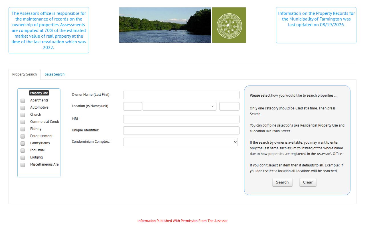
The assessor search image shows why a street directory should preserve parcel identifiers instead of copying only a name and number.
Farmington GIS Street and Parcel Layers
The Farmington GIS portal accepts a name, house number, street, or unique parcel ID. Select the parcel, open Parcel Information, and then move to the viewer for a street segment. Parcels and Street Labels make the first pass simple. Multi Select, Buffer, Measure, and Print are useful when the research question is a cluster of lots rather than one point.
GIS adds layers that explain place. Zoning, easements, open space, land use, historic districts, sewer and storm features, water companies, trails, schools, wetlands, FEMA mapping, sales by grand-list year, and aerials from 1934 through recent years can change how an older address is read. A parcel split may explain why a directory number no longer matches. The map is for assessment and orientation, not a conveyance or legal survey.
The Farmington GIS portal source is represented in the parcel-layer image.
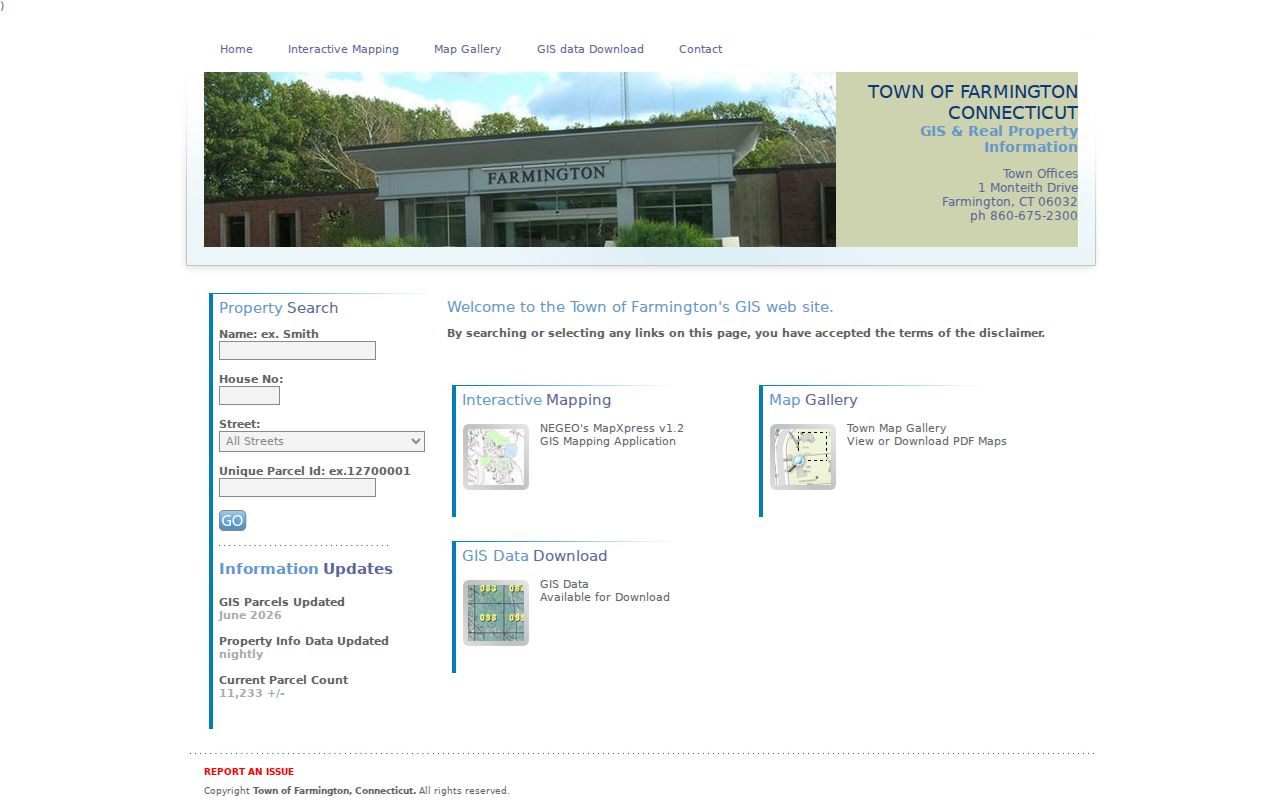
The GIS image belongs beside the search workflow because the street, house number, and unique parcel ID are the bridge between map and record.
Farmington Records Searchable by Street
The same address can appear in several systems, but each system has a different keeper and purpose. Use the coverage below as a handoff map. The assessor identifies the tax parcel. GIS shows physical adjacency. RecordHub supplies recorded instruments. Permits show work at an address. Voter information, when lawfully available, is a registration record rather than a complete household roster.
| Record Set | Keeper | Street-Level Signal | Access |
|---|---|---|---|
| Property card | Farmington Assessor | Owner, situs, mailing line, use, parcel ID, MBL, sales and building fields | Free public search; office help |
| GIS parcel | Farmington GIS / Engineering | Lot shape, adjacent parcels, zoning, easements, aerial and sales layers | Free interactive map |
| Deeds and liens | Town Clerk / RecordHub | Grantors, grantees, mortgages, liens, maps, easements, and past owners | Account and copy rules |
| Voter record | Registrars / Secretary of the State | Permitted registration, party, status, precinct, and district fields | Statutory purpose and privacy limits |
| Building permit | Farmington Building Department | Applicant, owner, contractor, project, inspections, and certificate trail | Portal or office request |
| Historical address file | Farmington Room / archives | Former occupants, architectural notes, maps, photographs, and notices | Room, staff, or selected digital access |
Parcel IDs and legal descriptions are the strongest join keys. A street name is helpful, but it can change, repeat in more than one village context, or be printed differently in an old directory. Keep the source label with every name.
Farmington Situs and Address Records
Situs means the physical parcel address used by the Assessor, GIS, and permit systems. Mailing address means where tax or assessment correspondence is sent. Legal description means the deed’s lot, map, subdivision, easement, or metes-and-bounds language. One record can contain all three, and they may not match.
A tax mailing line can belong to an owner who lives elsewhere, an entity, a business, or a separate post-office location. The situs can use Farmington while the postal line uses Unionville. The legal description can refer to a lot that predates a later street number. Searchers who collapse these fields risk assigning a person to the wrong building.
- Parcel
- A mapped land unit with an assessor identifier, MBL, and legal record trail.
- Situs address
- The physical location of the parcel, used for street browsing and many permits.
- Plat or map
- A recorded drawing that helps explain lot lines, subdivisions, roads, and easements.
- Criss-cross directory
- A historical directory organized by street or address, often paired with an alphabetical name section.
Farmington Deeds Along a Street
Farmington’s land records are held by the Town Clerk, not a Hartford County recorder. The town says the legal series reaches back to the mid-1600s. An official 2017 report documented internet land records from 1961 forward, while current pre-1961 image coverage was not separately verified. The land-record search route sends users to RecordHub, where an account is required for index and image access. Online prints cost $2 per page; certified copies come from the Town Clerk in person or by mail.
For one street address, begin with the current owner or grantee. Capture deed type, volume and page or instrument number, recording date, execution date, consideration, grantor, grantee, map or lot, legal description, easements, restrictions, and referenced prior deeds. Then search the seller as the next earlier grantee. A name alone is weak evidence. Parcel, spouse or entity, date, and legal description make the chain safer.
| Index entry | Party names, instrument or volume/page, document type, recording date, and image route. |
|---|---|
| Deed image | Grantor, grantee, legal description, consideration, references, easements, and restrictions. |
| Copy route | Online prints through RecordHub; certified or older copies through the Farmington Town Clerk. |
Farmington Permit Records by Address
Farmington Building Department pages say permits can be searched by address and that historic permits before January 1, 2017 were updated. A permit may name an applicant, owner, contractor, project type, valuation, inspection, final status, or certificate. It can help date an addition or conversion, but the applicant is not automatically the person who occupied the building later.
The live permitting portal returned a blocked response during research, so the office route matters. If a number or document does not open, contact the Building Department and give the address, permit number, project type, or date range. The official permits page is the safer starting point than a message asking for payment.
Farmington Reverse Directory Shelf
The Farmington Room’s local directory collection spans 1907 through 2006, with the bulk in the late 1920s through late 1970s. The public description does not publish every year or publisher, so ask staff to confirm the exact volume. When a reverse or criss-cross section exists, start with the street and number. Copy the printed address, occupant, spouse or widow notation, occupation, and any symbol exactly before checking the alphabetical section.
A directory year is a time slice. It can show that a name was printed at an address, but it may not show every person in the household and it does not prove a current connection. Pair the entry with a deed, grand list, census, newspaper notice, obituary, or historic-home file. The collections and reading method are treated end to end on the Farmington city directory page.
Farmington Voter-by-Street Limits
Connecticut’s voter system is maintained by local registrars in a statewide platform. The documented query schema includes last name, first name, date information, current or previous address, street name, voter ID, DMV ID, scope, and status. The public lookup is dynamic, and the full voter file requires a $300 request to SOTS for a permitted election, scholarly, journalistic, political, or governmental purpose.
Street research should never harvest a block roster. Public voter output can be limited to lawful fields, with year of birth rather than month and day under the current guidance. Protected voters and ACP participants may be withheld or represented by a substitute address. A voter entry is registration evidence, not proof that every person at the situs lives there now.
What a Farmington Street Directory Cannot Show
A public street directory can show owners, recorded parties, parcel geometry, permit activity, historical occupants, and selected registration fields. It cannot show every person who sleeps at an address. DMV information is protected by the federal DPPA and CGS §14-10. Utility customers, delivery records, unlisted contact details, and private membership lists are not ordinary street-search fields.
Use the tax mailing address as a clue, not a residence conclusion. Treat an old directory entry as dated evidence. Do not use a map buffer to suggest a social relationship between adjacent households. The point of a street search is to understand the public record, not to turn separate records into a private dossier.
Lawful use. Farmington address records can support personal research, family history, property questions, and civic work. Using them to stalk, harass, threaten, or intimidate another person can violate Connecticut law.
Request an Older Farmington Street Record
When an online search ends, ask the custodian that owns the next layer. The Town Clerk is the route for older deed books, maps, and certified land copies. The Farmington Room can search the local directory, newspaper, obituary, and historic-home shelves. The Connecticut State Library and Archives guide researchers to town documents, probate, maps, census, cemetery, and old-house sources. The Connecticut Freedom of Information guidance is appropriate for a defined public record request, not a request for a person’s entire file.
Give the office a street spelling, house number, approximate year, parcel ID or MBL, and the kind of record sought. Ask whether a map, deed reference, directory volume, or staff-assisted search can bridge a missing year. A clear date range saves time and leaves a record of what was actually checked.